Irvine sits on a complex alluvial basin underlain by the Santiago and San Joaquin Hills formations. The city's rapid master-planned growth demands reliable subsurface data before any grading or foundation work. Per ASTM G57-06 and IBC Chapter 18, electrical resistivity imaging provides continuous profiles of soil resistivity without drilling. We deploy Vertical Electrical Sounding (VES) arrays to detect clay lenses, water tables, and corrosive zones. This method is especially relevant in Irvine's coastal plain, where saline intrusion and variable sediment layers can compromise concrete and steel. Complementing the VES survey with a vs30/" data-interlink="1">MASW / VS30 survey improves shear-wave velocity mapping for seismic site classification under ASCE 7.
Irvine's alluvial stratigraphy changes within meters. VES imaging reveals buried stream channels and perched water tables before a single borehole is drilled.
Methodology and scope
Local considerations
Irvine's development history accelerated after the 1960s master plan, transforming former ranchlands into high-density neighborhoods. This rapid urbanization buried old drainage channels, undocumented fill, and agricultural infrastructure under paved surfaces. Without electrical resistivity mapping, a project can unknowingly build on a paleo-channel filled with loose sand or soft clay. The risk manifests as differential settlement or unexpected groundwater ingress during excavation. Our VES surveys identify these hazards early, allowing the design team to adjust foundation depths or specify ground improvement before mobilizing heavy equipment.
Applicable standards
ASTM G57-06 (Field Measurement of Soil Resistivity), IBC 2021 Chapter 18 (Soils and Foundations), ASCE 7-22 Section 11.4 (Site Class Determination)
Associated technical services
2D Resistivity Imaging (Schlumberger Array)
Multi-electrode survey with 28 to 56 electrodes. Produces a continuous 2D cross-section of resistivity values. Ideal for detecting lateral changes in Irvine's alluvial layers, such as clay channels or sand lenses.
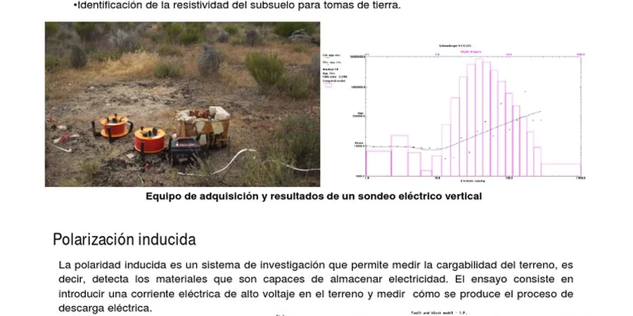
Vertical Electrical Sounding (VES)
Centralized array expanding outward from a fixed point. Provides 1D depth-resistivity curves. Best for quantifying layer thickness and groundwater depth at specific borehole locations in Irvine's sedimentary basin.
Dipole-Dipole Resistivity Profiling
High-resolution array for shallow targets. Resolves buried structures, voids, and contamination plumes. Used in Irvine for environmental site assessments and utility clearance before trenching.
Typical parameters
Frequently asked questions
What is the difference between VES and 2D resistivity imaging?
VES provides a 1D depth profile at a single point, ideal for layer thickness and groundwater depth. 2D imaging uses multiple electrodes along a line to produce a continuous cross-section, revealing lateral changes in soil resistivity across a site.
How deep can electrical resistivity surveys reach in Irvine soils?
In Irvine's alluvial basin, standard VES surveys reach 30 to 50 meters (100 to 160 feet) depending on electrode spacing and soil conductivity. The depth decreases in high-conductivity clay layers but still covers typical foundation depths.
Can resistivity surveys detect underground tanks or old utilities?
Yes. Buried metallic objects, plastic pipes, and concrete structures produce distinct resistivity anomalies. The method is routinely used in Irvine for environmental site assessments and utility clearance before excavation.
How much does an electrical resistivity survey cost in Irvine?
For a typical residential or commercial lot, the cost ranges between US$570 and US$980. Final pricing depends on line length, electrode count, and site accessibility. We provide a firm quote after reviewing the project scope.